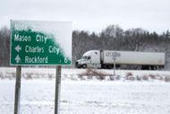
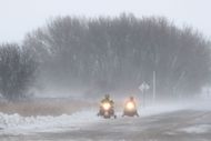
As the United States gears up to celebrate Thanksgiving, a major winter storm is expected to cause havoc across the country, bringing travel troubles to millions. The National Safety Council has released a travel advisory and predicts a worrisome number of deaths resulting from dangerous situations. It predicts that the storm will impact one or the other area, more prominently the Midwestern, Southern, and Northeastern States, as the storm progresses from West to the East. It is expected to produce a mix of rain and snow and gusts of strong winds that will make travel conditions treacherous.
Key states affected
The states most likely to experience severe weather include Colorado, Nevada, California, Utah, Vermont, Wyoming, Michigan, New York, Alaska, Idaho, New Hampshire, Maine, and New Mexico.
These areas are expected to receive heavy snow, especially in the higher grounds, and in some mountainous regions, snow can accumulate to 3 inches at some point.
Detailed weather forecast

Western U.S.
It will start with snow and rain in the country's western states. Both Colorado and Utah have already implemented winter storm warnings. Road travelers should be prepared for challenging driving conditions on various highways, including Interstate 25 and Interstate 70. Though light showers are expected throughout Tuesday, Wednesday may bring significant amounts of precipitation that will cause roads to be closed and traveling to be slowed down.
Central and Eastern U.S.
As the storm moves slowly eastward on Thanksgiving Day, it will produce rain and snow in the central and eastern regions of the country. Some of the midwest and northeast states may initially get rain but will transition into snow as the arctic air from Canada moves in. The wind speed can be up to 30 mph; even worse, it can reduce visibility and lead to the risk of downed trees and power lines affecting traveling.
Potential scenarios

Intense and Slow-Moving Storm: This scenario implies snow from the Tennessee Valley into the Northeast with heavy rain in lowland regions. This could result in life-threatening weather situations, including a Thanksgiving parade with wind storms.
Weaker Southern Storm: If it stays along the mid-Atlantic coast, there will be comparatively less snow in the northeast areas and even more rain in Virginia or North Carolina.
Travel impact

Since AAA anticipates some 71 million people in the United States traveling during Thanksgiving, such disruptions can impact many people. The National Safety Council has predicted 502 fatalities in accidents owing to the dangerous driving environment during this time. Airports in the affected areas may also be forced to close temporarily because of poor visibility and bad weather that affect air operations.
Formation of winter storms

Air Mass Interaction
Winter storms are usually formed when the cold and dry arctic air blows southward to meet tropical air, which is warm and moist. This interaction forms a front, which is the line dividing the two air masses. The nature of this front—whether it is a cold front or a warm front—determines the type of precipitation that will occur:
Cold Front: If the cold air extends southward and overruns warm air, the latter brings about quick cooling and even snow.
Warm Front: Conversely, if warm air rises over cold air, it cools gradually, leading to prolonged and steady precipitation, often resulting in freezing rain or sleet.
Low-pressure systems
When these two air masses meet, they can create large low-pressure systems. One of the conditions states that warm air rises and cools, forming clouds with the chance of precipitation. These systems can generate snowy and windy weather because their dynamics are rather intense. The greatest winter storms occur in the late autumn and winter periods when seawater temperatures are relatively high while polar air temperatures are significantly low.
